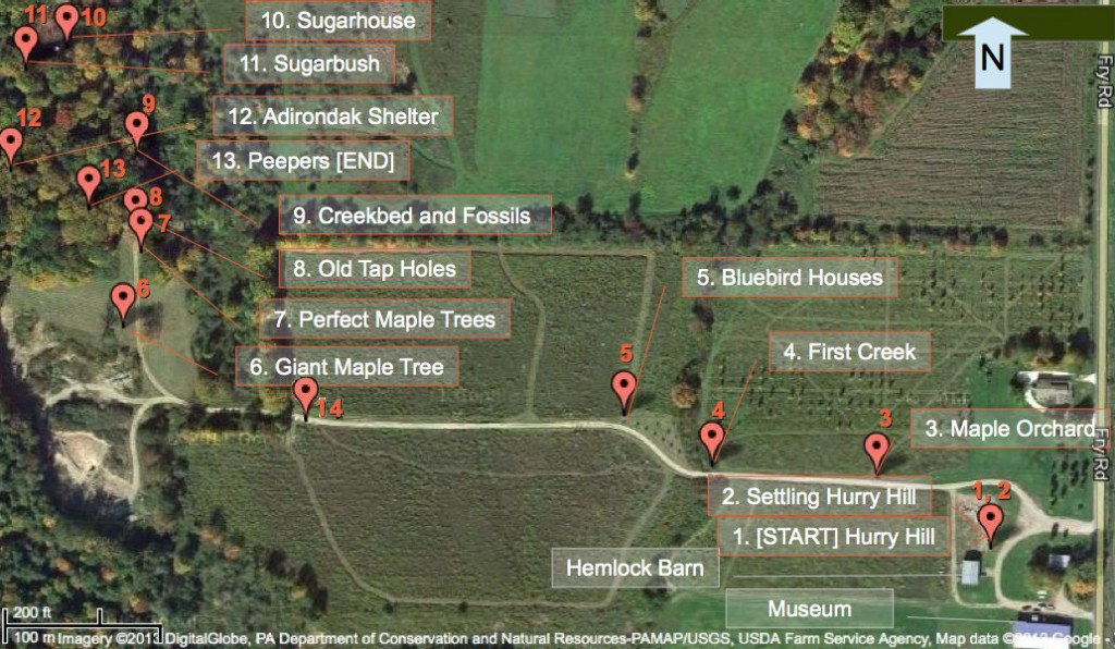
Get to know Hurry Hill Farm and its history as you follow this self-guided walking trail, stopping to learn from narratives at each of the numbered markers.

1. How Hurry Hill Got Its Name | 2. Settling Hurry Hill | 3. Maple Orchard | 4. First Creek | 5. Bluebird Houses
| 6. Giant Maple Tree | 7. Perfect Maple Tree | 8. Old Tap-holes | 9. Creek-bed and Fossils
| 10. Hurry Hill Sugarhouse | 11. Sugarbush | 12. Adirondack Shelter | 13. Peepers | 14. Museum
| Larger map image |Printable map
| 6. Giant Maple Tree | 7. Perfect Maple Tree | 8. Old Tap-holes | 9. Creek-bed and Fossils
| 10. Hurry Hill Sugarhouse | 11. Sugarbush | 12. Adirondack Shelter | 13. Peepers | 14. Museum
| Larger map image |Printable map
Related resources:
- Hurry Hill Farm Walking Trail – pdf file – contains the text of all 14 narratives. Optionally download before you leave home and take it with you on the trail.
- Walking trail map (larger image).
- Walking trail map (printable).
- Walking Trail QR Codes – use your smartphone to scan these QR codes to link directly to each of the narratives.
- Scan.me – QR scanning app for iPhone, Android or Windows smartphone.
